![](/images/other/stat-length.png)
![Tocht Stappen Auronzo di Cadore - Tour des Drei Zinnen - Tre Cime di Lavaredo - Photo](https://media.geolcdn.com/t/1900/400/b7e29343-e1e8-4f34-a7f5-961cca2da60c.jpg&format=pjpeg&maxdim=2)
Tour des Drei Zinnen - Tre Cime di Lavaredo
VacheKiri67
Gebruiker
![Lengte](/images/other/stat-length.png)
![Max. hoogte](https://static1.geolcdn.com/siteimages/upload/files/1508320355ic_sort_altitude_max_24dp.png)
![Positief hoogteverschil](https://static1.geolcdn.com/siteimages/upload/files/1508320355ic_sort_den_pos_24dp.png)
![Km-Effort](/images/other/stat-length.png)
![Min. hoogte](https://static1.geolcdn.com/siteimages/upload/files/1508320355ic_sort_altitude_min_24dp.png)
![Negatief hoogteverschil](https://static1.geolcdn.com/siteimages/upload/files/1508320355ic_sort_den_neg_24dp.png)
![Boucle](https://static1.geolcdn.com/siteimages/upload/files/16400158638029165_repeat_loop_refresh_sync_direction_icon.png)
![Stappen](https://static1.geolcdn.com/sitytour/trail-icons/101.png)
5h29
Moeilijkheid : Medium
![Scan deze QR-code om de tocht te openen in de SityTrail-applicatie](https://capi.geolives.com/qq0zvz2zws4bq2lad0pu/sitytour/trails/3321036/qr.png?size=200)
Gratisgps-wandelapplicatie
Over ons
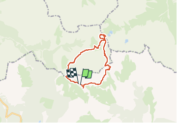
Tocht Stappen van 11,2 km beschikbaar op Veneto, Belluno, Auronzo di Cadore. Deze tocht wordt voorgesteld door VacheKiri67.
Beschrijving
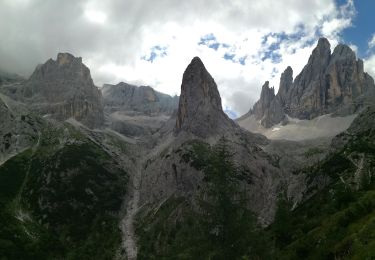
Faite le 18/07/2022.
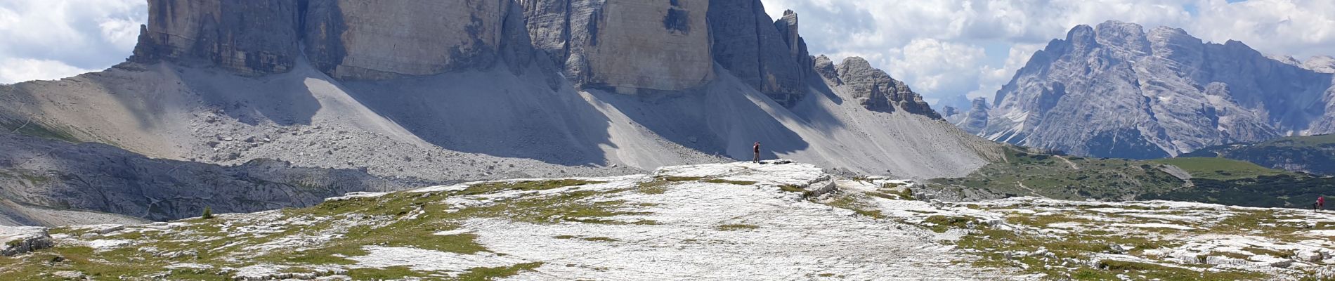
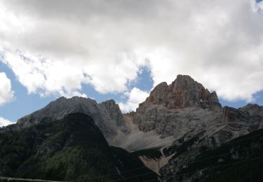
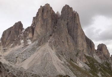
Juste magnifique !
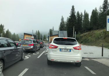
Malgré la fréquentation, le prix du parking, ce site reste incontournable.
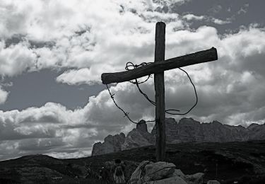
Parking Auronzo Hütte 2320m. Attention nombre de places limitées et route fermée après 9h30.
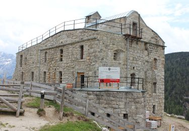
Aller par balisage 101, passage à la Lavaredo Hütte 2344m, Drei-Zinnen Hütte-Locatelli 2405m. Retour par balisage 105, col Forcellina, Langalm Hütte 2283m.
Ce parcours est souvent noté facile dans les guides pour une une durée indiquée de 4h. Mais le retour avec plusieurs montées successives peut sembler usant surtout si on n'est pas encore habitué à l'altitude.
Plaatsbepaling
Opmerkingen
Wandeltochten in de omgeving
![Tocht Te voet Toblach - Dobbiaco - IT-34 - Photo](https://media.geolcdn.com/t/375/260/446455bc-f23e-463a-8951-9c95d3a75a14.jpeg&format=jpg&maxdim=2)
![Te voet Te voet](https://static1.geolcdn.com/sitytour/trail-icons/100.png)
Te voet
![](/images/other/stat-length.png)
![](https://static1.geolcdn.com/siteimages/upload/files/16400158638029165_repeat_loop_refresh_sync_direction_icon.png)
![Tocht Te voet Toblach - Dobbiaco - IT-6A - Photo](https://media.geolcdn.com/t/375/260/76df3c86-847a-4978-9d68-e8b455bcf776.jpeg&format=jpg&maxdim=2)
![Te voet Te voet](https://static1.geolcdn.com/sitytour/trail-icons/100.png)
Te voet
![](/images/other/stat-length.png)
![](https://static1.geolcdn.com/siteimages/upload/files/16400158638029165_repeat_loop_refresh_sync_direction_icon.png)
![Tocht Te voet Auronzo di Cadore - IT-107 - Photo](https://media.geolcdn.com/t/375/260/dd557ee7-c649-420f-b769-506ee15c33f7.jpeg&format=jpg&maxdim=2)
![Te voet Te voet](https://static1.geolcdn.com/sitytour/trail-icons/100.png)
Te voet
![](/images/other/stat-length.png)
![](https://static1.geolcdn.com/siteimages/upload/files/16400158638029165_repeat_loop_refresh_sync_direction_icon.png)
![Tocht Te voet Auronzo di Cadore - IT-120B - Photo](https://media.geolcdn.com/t/375/260/15109c8f-7403-4c46-b036-7bf49e909e9a.jpeg&format=jpg&maxdim=2)
![Te voet Te voet](https://static1.geolcdn.com/sitytour/trail-icons/100.png)
Te voet
![](/images/other/stat-length.png)
![](https://static1.geolcdn.com/siteimages/upload/files/16400158638029165_repeat_loop_refresh_sync_direction_icon.png)
![Tocht Te voet Auronzo di Cadore - IT-120A - Photo](https://media.geolcdn.com/t/375/260/6efd543a-289e-46ba-bacc-2cf3cf0635b7.jpeg&format=jpg&maxdim=2)
![Te voet Te voet](https://static1.geolcdn.com/sitytour/trail-icons/100.png)
Te voet
![](/images/other/stat-length.png)
![](https://static1.geolcdn.com/siteimages/upload/files/16400158638029165_repeat_loop_refresh_sync_direction_icon.png)
![Tocht Te voet Auronzo di Cadore - IT-224 - Photo](https://media.geolcdn.com/t/375/260/e55a9ad6-7aea-4c33-835d-e0d4748fed08.jpeg&format=jpg&maxdim=2)
![Te voet Te voet](https://static1.geolcdn.com/sitytour/trail-icons/100.png)
Te voet
![](/images/other/stat-length.png)
![](https://static1.geolcdn.com/siteimages/upload/files/16400158638029165_repeat_loop_refresh_sync_direction_icon.png)
![Tocht Te voet Auronzo di Cadore - IT-121 - Photo](https://media.geolcdn.com/t/375/260/37f56822-b316-4a36-8ac8-0d01e86bfab7.jpeg&format=jpg&maxdim=2)
![Te voet Te voet](https://static1.geolcdn.com/sitytour/trail-icons/100.png)
Te voet
![](/images/other/stat-length.png)
![](https://static1.geolcdn.com/siteimages/upload/files/16400158638029165_repeat_loop_refresh_sync_direction_icon.png)
![Tocht Te voet Auronzo di Cadore - IT-1104 - Photo](https://media.geolcdn.com/t/375/260/249b33b9-2839-496a-9dac-af06e055b4c1.jpeg&format=jpg&maxdim=2)
![Te voet Te voet](https://static1.geolcdn.com/sitytour/trail-icons/100.png)
Te voet
![](/images/other/stat-length.png)
![](https://static1.geolcdn.com/siteimages/upload/files/16400158638029165_repeat_loop_refresh_sync_direction_icon.png)
![Tocht Te voet Auronzo di Cadore - Misurina Casello - Rifugio Auronzo - Photo](https://media.geolcdn.com/t/375/260/7339d0bc-f222-48fd-81dc-37b943876226.jpeg&format=jpg&maxdim=2)
![Te voet Te voet](https://static1.geolcdn.com/sitytour/trail-icons/100.png)
Te voet
![](/images/other/stat-length.png)
![](https://static1.geolcdn.com/siteimages/upload/files/16400158638029165_repeat_loop_refresh_sync_direction_icon.png)